CASE STUDY – GEOGRAPHIC INFORMATION SYSTEMS OUTLINED
A geographic information system, geographical information science, or geospatial information studies is a system designed to capture, store, manipulate, analyse, manage, and present all types of geographically referenced data. In the simplest terms, GIS is the merging of cartography, statistical analysis, and database technology.
A GIS can be thought of as a system—it digitally creates and “manipulates” spatial areas that may be jurisdictional, purpose or application-oriented for which a specific GIS is developed. Hence, a GIS developed for an application, jurisdiction, enterprise or purpose may not be necessarily interoperable or compatible with a GIS that has been developed for some other application, jurisdiction, enterprise, or purpose.
What goes beyond a GIS is a spatial data infrastructure (SDI), a concept that has no such restrictive boundaries.
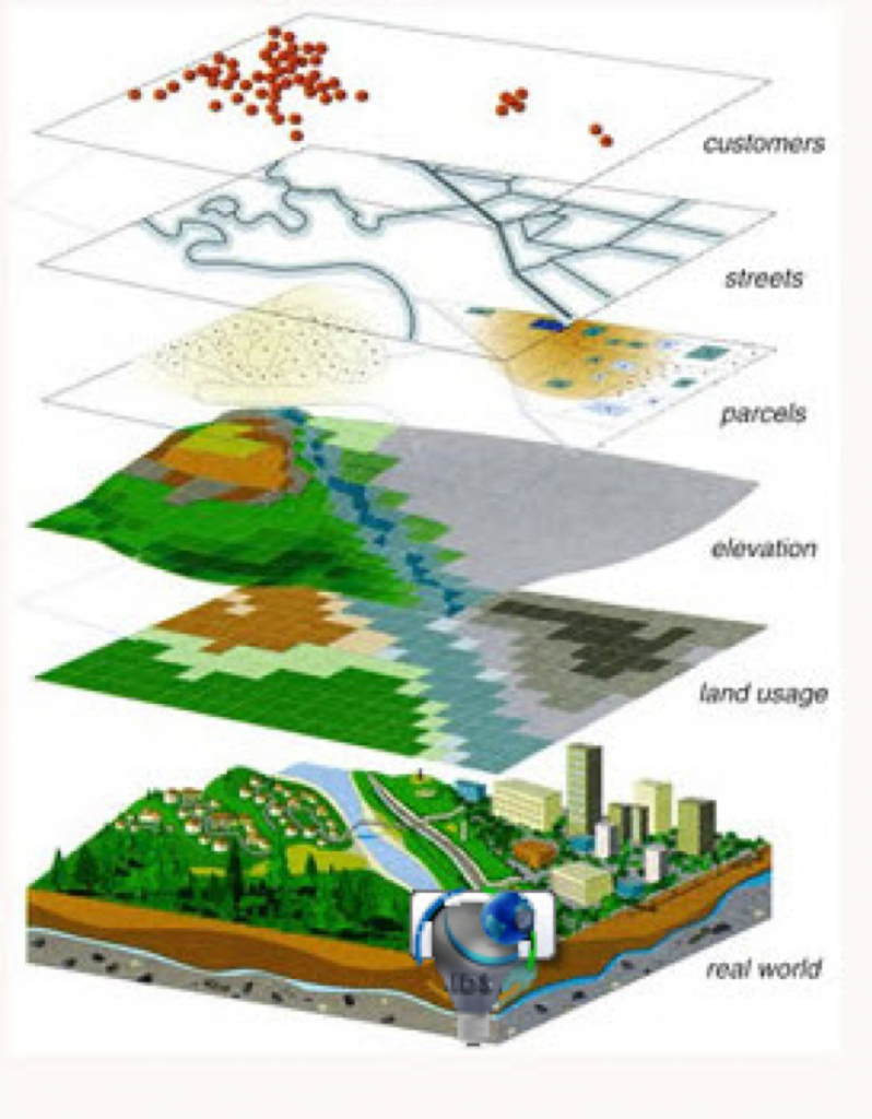
Therefore, in a general sense, the term describes any information system that integrates, stores, edits, analyses, shares and displays geographic information for informing decision making.
The term GIS-centric, however, has been specifically defined as the use of the Esri ArcGIS geodatabase as the asset/feature data repository central to computerised maintenance management system (CMMS) as a part of enterprise asset management and analytical software systems. GIS-centric certification criteria were specifically defined by NAGCS, the National Association of GIS-Centric Solutions.
GIS applications are tools that allow users to create interactive queries (user-created searches), analyse spatial information, edit data, maps, and present the results of all these operations. Geographic information science is the science underlying the geographic concepts, applications and systems.